Why Cobá Is Different
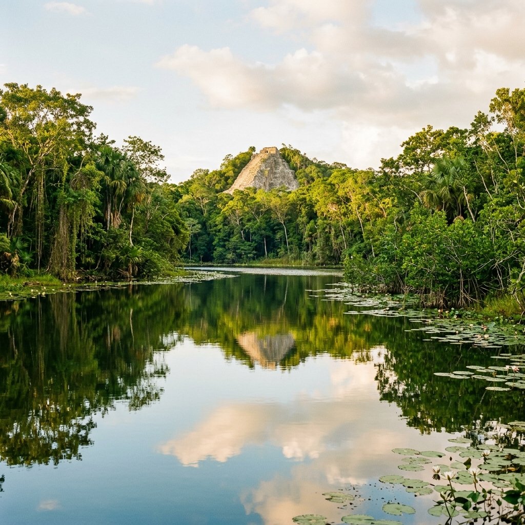
While most Maya sites have been stripped of their jungle context — cleared, restored, and fenced — Cobá remains wrapped in living forest. The site covers over 80 km², making it one of the largest Maya cities ever built, but only a fraction has been excavated. You literally ride past unexcavated mounds — pyramids still sleeping under 1,000 years of trees. It's the closest thing to being the first person to rediscover a lost city, except there's a bicycle rental at the entrance.
History: The Hub of an Empire
Cobá was founded in the Late Preclassic period (100 BC–100 AD) and rose to become one of the largest and most powerful cities in the eastern Yucatán by the Early Classic (250–600 AD). At its peak, the city supported an estimated 50,000 inhabitants — one of the largest populations in the Maya lowlands — and controlled a territory that stretched from the Caribbean coast to the interior of the peninsula.
What made Cobá powerful wasn't just its size — it was its location. Situated among a cluster of five shallow lakes (remarkable in the waterless Yucatán limestone landscape), Cobá controlled access to water in a region where water meant everything. But its true innovation was infrastructure.
The Sacbés: Maya Highways
Cobá was the hub of the most extensive sacbé (white road) network in the pre-Columbian Americas. The word literally means "white road" — sac (white) + bé (road) — because the roads were surfaced with compacted white limestone that would have gleamed in the tropical sun.
Sacbé Facts
- 50+ sacbés radiate from Cobá
- Sacbé 1: 100 km to Yaxuná — the longest known Maya road
- Width: 3–10 meters across
- Height: Raised 0.5–2.5 meters above ground level
- Surface: Compacted white limestone plaster
- Construction: Stone retaining walls filled with rubble and surfaced
Why They Matter
- Enabled rapid troop movement and trade
- Connected Cobá to allies and subject cities
- Raised above flood-prone terrain — all-weather
- Visible political statement: power projected through infrastructure
- Still walkable/bikeable today after 1,300+ years
- Comparable to Roman roads in engineering ambition
The 100-km Sacbé 1 connecting Cobá to Yaxuná is particularly significant. It was built in a nearly perfectly straight line across 100 km of dense jungle and rough limestone terrain — requiring sophisticated surveying techniques and coordinated labor on a massive scale. Archaeologist David Maldonado Cárdenas has estimated that the road required over 500,000 cubic meters of stone fill (Maldonado, Ancient Mesoamerica, 2006).
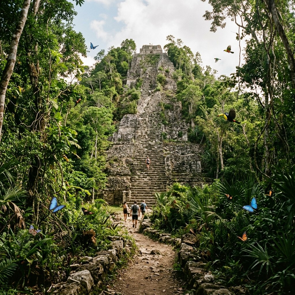
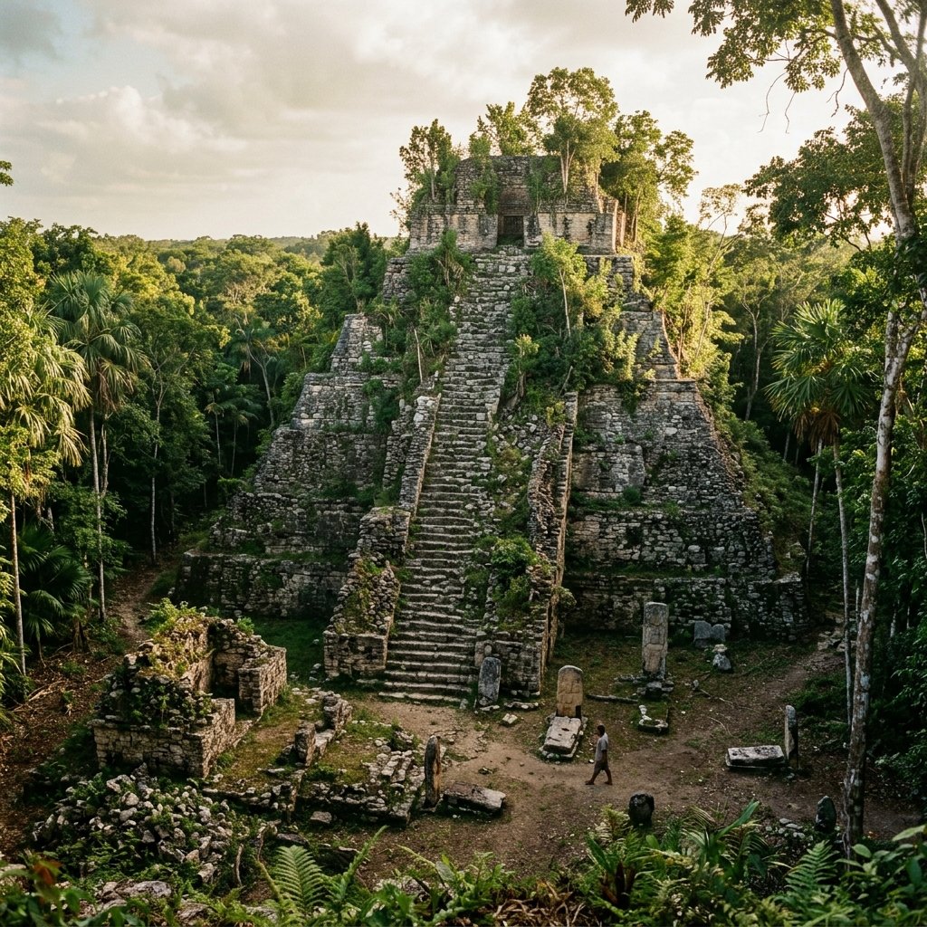
Nohoch Mul: The Tallest Climbable Pyramid
At 42 meters (138 feet), Nohoch Mul ("Great Mound") is the tallest pyramid in the northern Yucatán and the tallest Maya pyramid you can still climb anywhere. For context:
| Pyramid | Height | Climbable? |
|---|---|---|
| Nohoch Mul, Cobá | 42 m | ✅ Yes |
| Acropolis, Ek Balam | 31 m | ✅ Yes |
| El Castillo, Chichén Itzá | 30 m | ❌ No (since 2006) |
| Temple IV, Tikal | 65 m | ✅ Via wooden staircase |
| La Danta, El Mirador | 72 m | ✅ (5-day jungle trek required) |
The 120 steps to the summit are steep and uneven — this is an original Maya staircase, not a modern reconstruction. At the top, a small temple still bears traces of carved decoration. But the real reward is the view: 360° of unbroken jungle canopy stretching to every horizon, broken only by the distant bumps of unexcavated pyramids still hidden under the trees.
This view is the single best illustration of what LiDAR has revealed: every one of those bumps is a building. The jungle isn't empty — it's full.
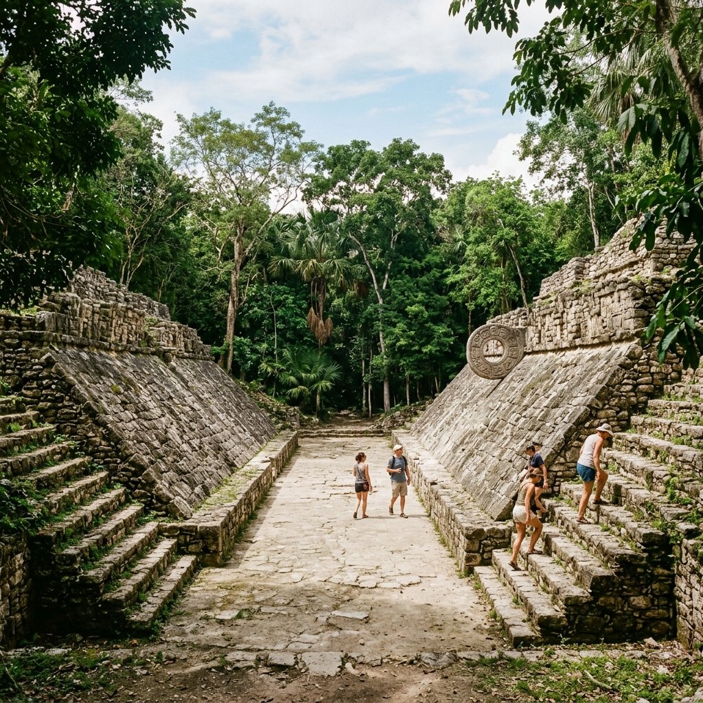
Other Key Structures
Visitor's Guide
| Location | 47 km NW of Tulum, 44 km SE of Valladolid, Quintana Roo, Mexico |
| Entrance Fee | ~100 MXN (~$6 USD) + optional bike rental ~60 MXN |
| Hours | 8:00 AM – 5:00 PM daily |
| Time Needed | 3–4 hours (with bike). Walking only: plan 4–5 hours |
| Bike or Walk? | Bike. The site is 80 km². Walking between structure groups takes 30+ min each. Bikes are the best investment you'll make |
| Getting There | 45 min from Tulum, 1 hr from Valladolid, 2.5 hrs from Cancún. ADO buses run from Tulum & Playa del Carmen |
Insider Tips
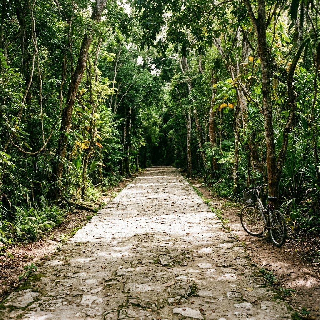
Rent a bike, not a bicitaxi. Bicitaxis (pedicabs) are available, but riding yourself gives you freedom to stop, explore side trails, and visit the quieter structure groups at your own pace. The roads are flat and smooth — anyone can ride them.
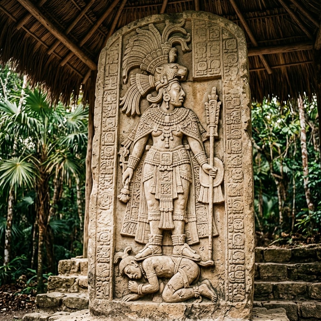
Visit the Macanxoc group. Most tourists ride directly to Nohoch Mul and back. The Macanxoc group — a 10-minute bike ride in a different direction — has the best stelae and is often completely deserted. This is where the female-ruler stelae are located.
Go early or late. 8 AM or after 2 PM. The midday bus tours (10 AM–1 PM) flood the main path. Early morning also gives you the best chance of seeing spider monkeys, toucans, and coatimundis on the bike trails.
Combine with Tulum. Cobá → Tulum is a natural day trip. Start at Cobá (8 AM), bike the ruins, then drive 45 min to Tulum for the afternoon coastal views. Two utterly different Maya experiences in one day.
Bring bug spray. Cobá is thick jungle. Mosquitoes are present, especially in the morning and late afternoon. DEET-based repellent is recommended. Also: sunscreen for the pyramid top, water (at least 1L), and a hat.
Frequently Asked Questions
Can you still climb the pyramid at Cobá?
As of early 2025, yes — Nohoch Mul remains climbable, making it one of the last major Maya pyramids where visitors can reach the summit. However, there have been periodic discussions about closing it for preservation. If climbing a Maya pyramid is on your bucket list, don't wait.
Is Cobá better than Chichén Itzá?
Different, not necessarily "better." Chichén Itzá has grander restored architecture and richer historical interpretation. Cobá offers a more authentic, adventurous experience — jungle immersion, bike exploration, climbable pyramids, wildlife encounters, and far fewer crowds. If you care about experiencing a Maya city rather than looking at one from behind a rope, Cobá wins.
How much of Cobá has been excavated?
Less than 5%. The site covers over 80 km² and contains an estimated 6,500+ structures. Only a handful have been excavated and restored. The vast majority remain buried under jungle vegetation — visible only as tree-covered mounds. This is both Cobá's limitation (much remains unknown) and its magic (genuine discovery is still happening).
References & Further Reading
- Maldonado Cárdenas, R. (2006). "The Sacbeob of the Northern Maya Lowlands." Ancient Mesoamerica, 17(1), 1–11.
- Martin, S. & Grube, N. (2000). Chronicle of the Maya Kings and Queens. Thames & Hudson.
- Folan, W. J., et al. (1983). Cobá: A Classic Maya Metropolis. Academic Press.
- Shaw, J. M. (2008). White Roads of the Yucatán. U of Arizona Press.